Applications:
- Road management
- Power industry
- Transport
- Contact system monitoring
- Urban planing
- Spatial planning
- Housing and communal services
- Pipe installation
- Environmental monitoring
- Disaster management

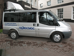
The 3D Mobile Mapping System combines the best features of terrestrial and airborne laser scanning technologies. It has spatial data acquisition rate and scope typical for airborne laser scanning systems, coupled with details and accuracy characteristic of terrestrial ones. Gaging unit of the system installed on the car that makes it possible to collect geodesic data at the time of driving.
| 3D rendering of the locality based on mobile laser scanning survey data. Avtozavodsky bridge, 3rd transport ring, Moscow |
|
Applications:
|  |
Technology advantages:
 |  |
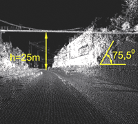
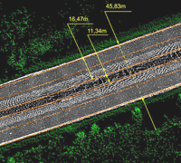
| Measurements by cloud of laser points | Roadway marking |
 | |
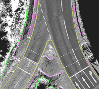
| Roadway infrastructure componentry marking. | |